Climb – Mt. Stuart West Ridge Date(s) – July 5-8, 1996
Area/Range – Alpine Lakes Region/Stuart Range
Approach Route – Surprise Lake Trailhead #1060 to Ingalls Pass
Ascent Route – West Ridge
Decent Route – West Ridge Couloir
Altitude – 9,415 feet Elevation Gain – 4,200 feet
Total Distance – 12 miles Maps/Guides – Becky Guide, page 328, Alpine Lakes Guide page 42, Green Trails Topo #176 Stevens Pass
Times: Approach – 3 – 4 hrs. to Ingalls Creek Ascent – 1.5 days Decent – 1.5 days
Grade – II Class – 5.6/5.7 Pitches – many
Equipment Used/Recommended – 2 – 60 meter ropes, stoppers & cams, long slings & extra biners, (a few pitons wouldn’t be out of place) pickets would have been useful for snow belays.
Weather – Good weather, clear skies, cold Friday, warming as weekend progressed. Cooled down on our bivy’s to low 40’s – high 30’s
Climbing Partners – Tom, Rick, Nicole
Climb Leaders – Les Profitt Number in Party – 4
Flora/Fauna – Wildflowers, saw a few marmots & picas. Lots of Goat tracks. Saw one goat.
“Without a rival as the crown peak in the central Cascades of Washington, Mount Stuart has been pronounced the single greatest mass of exposed granite in the United States…its northern and eastern faces are the alpine climax of the Wenatchee Mountains. They make a powerful impact on first sight…The mountaineering problems are magnified by the mountain’s massive dimensions and its complexity.” “Cascade Alpine Guide” by Fred Beckey.
Quote from Rick Baker during the climb: “Beckey is one lying-ass MF!”
This recollection/trip report from one of my climbing logs was written right after we returned from the climb back in 1996. It has gotten dusty and moldy over the last 25 years, but I cleaned it up and added photos from the trip.
====================================================
After celebrating the 4th of July the day before, we met at Rick’s house around noon on Friday and headed over to Alpine Experience to get a bivy sack for Tom. I had decided I wasn’t taking a sleeping bag and Tom decided to join me and get a bivy sack.
Rick said the hell with that, he was taking his sleeping bag. I decided I needed to go through his pack and take out some stuff I already had or he didn’t need. That boy could squirrel away more shit than he ever uses (he was packing a half gallon of bourbon and 2 full rolls of TP on top of everything else).
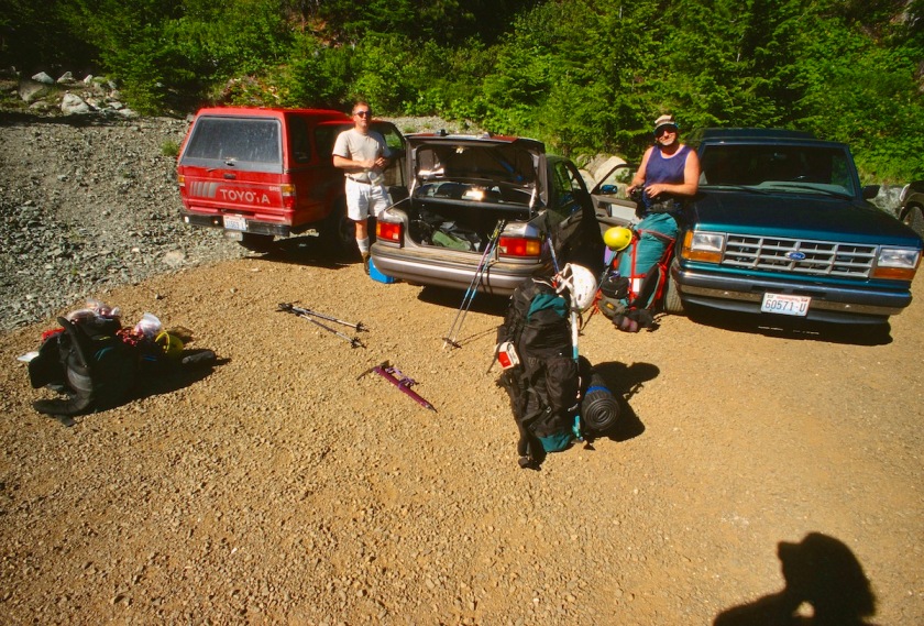
The drive over to the east side of the mountains from Olympia was uneventful. We arrived at the trail head somewhere around 3:30 or 4:00 and found a note on the trailhead bulletin board that Nicole, our 4th, had gone up the trail the day before saying that she had a stove and bottle of fuel with her to camp out at Ingall’s pass.

We made it up the mountain to the pass in a couple of hours with Rick dragging ass with all the shit he was still carrying and just because he was Rick.

I cruised a little faster and found Nicole sleeping in a group of trees. She had her stuff spread out all over the place and I told her we planned to keep going to get down into the big bowl below the West Ridge before nightfall.
She had been playing that morning and did Ingall’s Peak with some folks she met up there. While she was packing her stuff I dropped my pack and went back to see what was taking Tom and Rick so long. Tom had waited at the pass to make sure Rick was on the right path, he was still moving pretty slow.
We all saddled up and headed cross-country across the snow covered slopes. We descended down into the bowl below Ingall’s lake (which was still frozen over) and proceeded to beat the bushes and cross snow and rock slabs to a site just the other side of Ingall’s Creek.
It was about 9:00 PM by the time we dropped our packs and we were all pretty tired from the snow covered cross-country work.
We unrolled our sleeping gear, with Rick and Nicole playing up the fact that it was getting chilly and boy were they glad they had their sleeping bags. Tom and I put on our fleece and tried to play hardman with gritted teeth.
We cooked some dinner and sipped a little bourbon and turned in for the night after getting our stuff together for the climb the next morning.

I woke everyone around 5:00 AM and we got the last of our gear together and had a quick breakfast. Tom said the bivy sack thing sucked, his feet got damn cold. I knew he had hardly snored all night so he must have been cold!

I got a little chilly, but I had put on fresh socks so my feet weren’t too cold. Of course Rick and Nicole complained about how hot they had gotten during the night, poor babies.


We moved out and headed up the steep, open meadows and talus to the first continuous gully east of the west ridge.

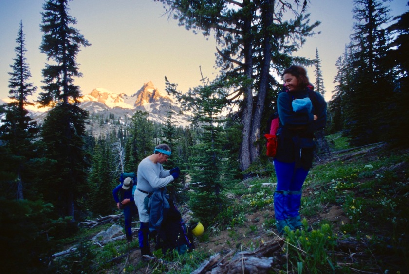
It was full of snow, unlike the last time we tried the route two years prior. It had been a heavy snow pack year and the mountain was still piled high with snow in the ravines.

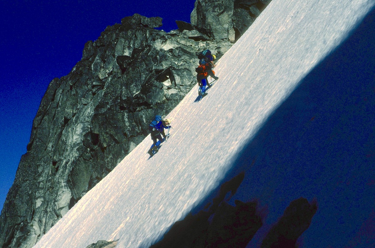
We put on crampons and headed up the steep, hard snow. It was steep enough that a slip would find you all the way back at the bottom.

We didn’t rope up because a fall would just have pulled the rest of the team off as well. It was every person for themselves.

The slope continued to get steeper until we were almost front pointing with our crampons and using our axes for hand holds.

Rick had been having problems keeping his crampons tight, in fact I had told him at our last break to make sure they were adjusted properly because the next slope was no place to blow a crampon. Of course he promptly lost a crampon when he was on a steep pitch.
I had just made it to an ice covered rock ledge when Rick started cussing and said his crampon had come off. I didn’t have a rope on me so I had to wait for Tom to get up to the ledge.
In the meantime I set up a couple of cams and slings for an anchor. Tom got up to me and I tossed the rope down to Rick, who was unable to move at all. His calves were beginning to cramp from the strain of keeping his one set of points in.
One slip and he would be off on a run that would go at least 600 feet. Rick tied in while trying to keep his balance on the ice slope and finally managed to get his crampon back on. All this took about an hour or so.

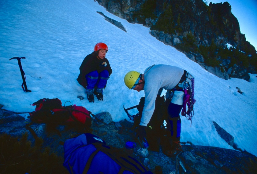
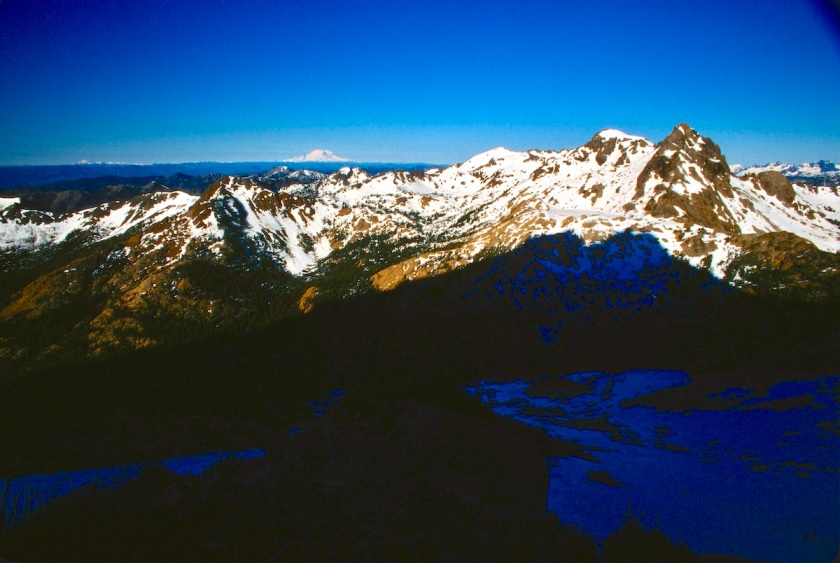
After the excitement, we continued up even steeper ice, higher and higher up the mountain.

The gully seemed to go on forever and our calves were beginning to feel strained. I had decided to just tie the rope to me and drag it up after me in case someone else lost a crampon or something. I could feel the extra drag from below for sure!
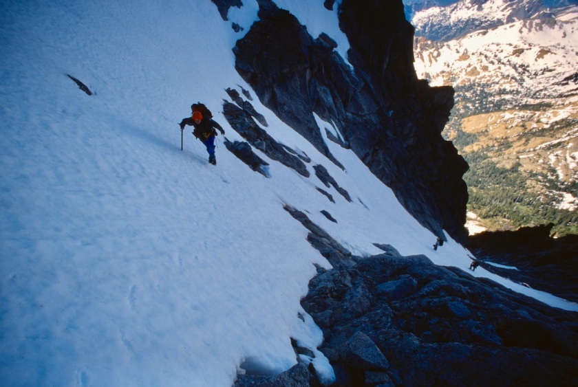
The snow was so steep and hard that there was little hope of self arresting. A fall would be all the way to the bottom. It was rather intimidating with all the exposure.


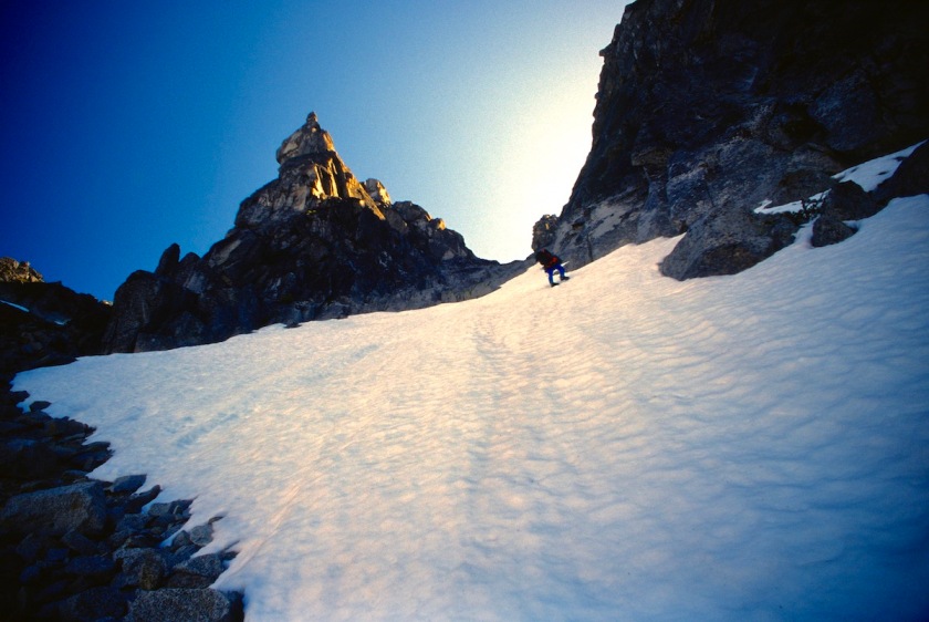

Finally we made it to the crest of the West Ridge, which was composed of loose rock mixed with large patches of snow. At least we were in the sun instead of the shady gully.
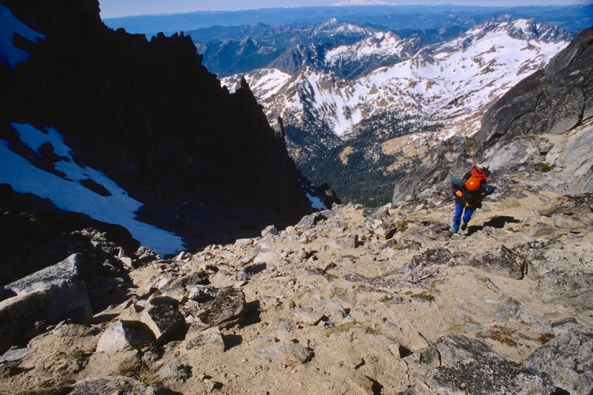

We continued up, crossing a couple of rock bands where we had to take our crampons off, then back on for more ice.

I was wishing we had brought some pickets and screws for the ice, but we had left all the snow protection at home.
We got off the ice and started climbing class 3 rock, across loose blocks and gritty ledges. This whole area has many possible ways to go, but many of them are dead ends that lead nowhere.
We traversed to the next gully over to the east and moved to the system under Long Johns Tower (8,700 ft.).
This area was very iced up and wet. I decided to drop my pack and lead it in my boots so that I could belay the others up. It had some moves that were difficult in hiking boots on wet, icy slabs.


Some of the moves were fairly run-out between protection, including moving out onto the face when the crack system began to overhang. This would have been pure pleasure on dry granite, but the theme of this climb was turning out to be wet, icy and slippery.
The chimney to the right looked easier, but it was full of snow and I couldn’t see a way to get into it. I reached a point where I didn’t see anywhere else to go, but found an old rusty piton someone had pounded in a long time ago.
I thought that was good enough for now and picked up a chunk of rock and pounded it in a little more solid, clipped it, placed a stopper and slung another big block for a belay.
I then brought Rick up (he wore his pack climbing up) using a little tight-rope hoisting action, to about halfway up the pitch and then he hauled the others packs to a ledge there.

This was necessary because I couldn’t see the others and there was an overhang the packs might get stuck under.

Rick clipped the packs off to a cam and came up, cleaning the rest of the route of gear. Nicole came up to the belay and then Tom moved up to where the packs were. We then hauled the packs to the belay and Tom then came up. This extra work from the snow and ice was taking a toll on time.
By now everyone was looking around wondering where the hell we were going from here. I had been checking out a potential route while I was belaying and they all looked fairly grim.

To the left was a blank slab, with no cracks for placing pro, leading to an overhanging roof. Directly overhead was a thin finger-tips crack that looked like it might go at 5.12.
What I was hoping would pan out was a move around the arête to the right that traversed under a huge loose-looking block that looked like if the wind blew too hard it would smash me to bits.
It looked like the best bet so I put my rock shoes on and headed out that way into who knew what.
I managed to avoid using the block for a hold and slowly worked my way up some loose chunks to a left slanting crack. Of course there was no place for any pro up to this point and everyone was getting pretty nervous down below (not as nervous as me!).
I had to make a pretty exposed move with no pro in, but I eventually got a piece in and made a few more nice moves to get to easier ground up higher. Again, the rock on Stuart is very clean granite compared to much of the funky, moss covered rock in the cascades but we were still a bit early on this route even in July it seemed.
I scrambled up to a nice ledge and set up a belay. We hauled packs up to that anchor and took a break and had some food.
Water was a real problem all the way up. All of us would take a drink and then top our bottles off with snow. I was sucking on chunks of ice and I could tell I was still getting dehydrated.
By now the sun was on us and it was hot with the reflector-oven action of the snow. Directly above the rock pitches was another steep ice chute, so the crampons went back on again. That section was another calf burner.
The team caught their breath while I scouted where the route went from there. There was supposed to be a couple of ways to move up, but it all looked snow covered and grim again.

While we were climbing the rock pitches, a group down below us had tried another way up and ended up having to rappel down after moving up several pitches into a dead end. We never saw them again, they must have bailed after that.
I moved us up to try the West Horn route, where there is supposed to be “a broad ledge 200 feet below the summit of the horn (9,100’) under a “scissor like formation”. I could see what I thought was the right formation, but the ledge looked like it disappeared for 20 or 30 feet.
By now it was 5:30 and it was obvious that if we did make the summit we would be down-climbing in the dark. We were very tired, hungry, and dehydrated.
Nicole wanted to go on, but I think it was only because she had no idea of the work involved in getting off the mountain in the dark and wanted to get back to camp.
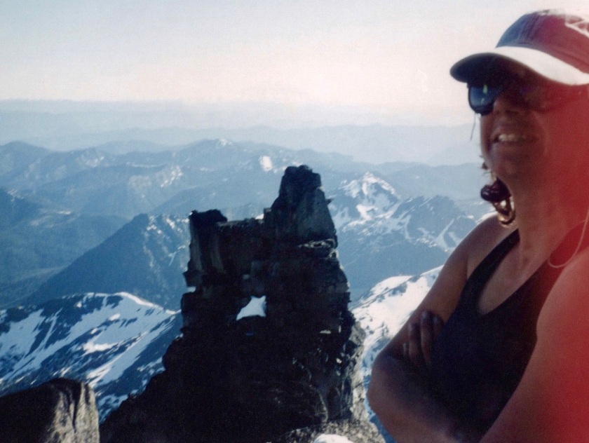
The vote was to do a bivy so that we could dry out our boots and socks before the sun went down, get some water and rest for the push in the morning.

I could tell Nicole was nervous about bivying that high on a steep mountain on a small perch. This was her first time bivying and we had no tents, sleeping bags, stove, etc.

Tom had carried his bivy sack as the designated safety bag in case someone got hurt, and he claimed it to sleep in.
Nicole had one of those thin foil-like rescue blanket things, we called it the pop-tart bag. Rick and I had Hefty trash bags and our packs pulled up around our legs.
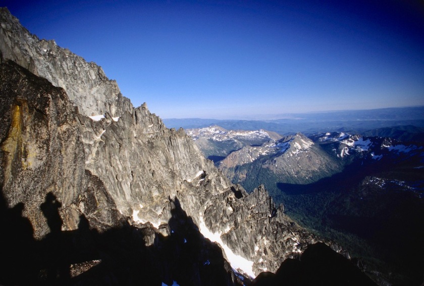
We all had our rain gear and pile jackets. We dug out a spot barely big enough to cram 4 people onto with our ice axes and stacked a rock wall on one side to keep us from rolling over the edge.

Rick found a drip from a chunk of ice and we slowly filled our water bottles. We ate what munchy food we had left (candy bars, cheese sticks, etc.) and started drying our clothing out.

As the sun went down it got colder and soon we were all hunkered together in our Gore-Tex and makeshift bivy gear watching the light over on Rainier and Adams. In the summer the sun stays up well past 9:00 PM at this latitude.


The night was uncomfortable but not totally hideous. The stars were actually beautiful in the clear air that high up. Everyone was stiff from the cold and all the climbing. Rick stuffed his ears with toilet paper to muffle Tom’s snoring.

I figured I wouldn’t sleep much anyway and didn’t bother. Of course Tom and I had good sport with the fact that there were two warm sleeping bags down at base camp all alone.
We watched the sun rise from high on our perch and started moving about to get warmed up and shake out the stiffness. We collected our gear and got suited up for the days activities.
I was looking around for a possible route and for a way to get up to the so-called “broad ledge” that was supposed to be there.
I found a way that led back up to the crest of the ridge and we followed it for a while, traversing east and moving up and down as the rock dictated.
We dropped down a bit and traversed over into the next gully system and I found a way to get up to the ledge that had looked so ominous the day before. It started out not too bad. A couple of short moves and we were on a fairly broad ledge, although it had tremendous exposure.
It dropped straight down for over a thousand feet to the gully below. Traversing along the ledge I got to the part where it looked bad from below. It now looked worse than bad up close.
The ledge shrank to almost nothing for about 15 feet. Then there was a gap of about 5 feet where there was no ledge at all, and you had to step across nothing to a big loose block on the other side that rocked when you got on it.
This would have been just a quick scamper if it was at sea level, but up here with the exposure it was rather intimidating.
When you looked between your legs or at your foot placements you could see down for what seemed like for-fucking-ever. Scary, but very cool and Alpine!
I dropped my pack and put on rock shoes to lead across it and put up a rope to belay the others up.


Rick volunteered to go last, knowing that meant that the piece of pro I put in the middle would be gone and the if he fell there was the possibility of a smashing pendulum into the other side that might dent his ass like the fall he took on Knife in the Toaster, but that’s another story.
We hauled packs across and Rick made it just fine. Broad ledge indeed.
I then looked across to the next section and decided we needed to down climb a bit across an interesting system of ledges. This was again tricky route finding.
We came to several dead ends and had to back track for short sections, moving either up or down to the next ledge. We came to a fairly steep ice section that we had to traverse.
The run-out was again all the way down the mountain so slipping was out of the question. Solid crampon placements and good ice ax belays were needed here.
It moved across a very steep section to a corner where it eased a bit. Then you had to down climb about 50 feet of very steep ice to a blocky ledge. I tried to kick pigeon holes as deep as I could for the others to follow.

Nicole thought this was the most intimidating section of the trip. It was kind of scary thinking about falling there.
Eventually we moved our way up and around to the west ridge notch, a deep cleft that marks the base of the final summit block. On the north side it drops off so fast it makes your head swim from just looking that direction.
The south side offers a bit of a help, but it quickly went no where. I saw a big ledge down below about 200 feet, so we again put on crampons and descended a steep gully to the ledge.

Everybody else took a break while I scouted the ledge. I down climbed for several hundred feet only to find the ledge dead ended at a nasty looking drop. I climbed back up and told them we needed to climb back up the gully and find a different route. Grumble, grumble.
We searched high and low and decided to start rock climbing a pitch that didn’t look too awful. We got up to a ledge that went to the north and south. I followed it both ways looking for a route but nothing looked obvious.
The north side was covered with a big patch of crusty snow and got real steep. The west face was also steep and slightly overhung, while the south side was sunny, but long and steep with a wild system of cracks with snow all over it.
We went to the south and scoured the rock for a possible route. Nothing seemed to look like it was under 5.9, and there was supposed to be a 5.6 route. Back to the North side for another look.
The snow looked too dangerous to try moving through it on such a steep face. Back to the south side and a descent down a loose funky ledge to nothing. Back up to the ledge and a team meeting about the possibilities.
We were only about 150 feet from the summit. A single rope length. We could see people looking over the edge and could hear them talking. They had gone up the much easier Cascadian Couloir, the standard route which is simply a walk up, comparatively. That was the easy gully route we had planned to descend.
The thought of going back down anything like we came up was extremely uncomforting. The snow was getting soft and balling up under crampons.
One of the issues was that there was a solid layer of ice a few inches under the soft snow on top, making every step on the steep snow totally unpredictable and prone to blowing out.
Everyone was tired, water was still scarce so everyone was again dehydrated. We were all out of any substantial food. We did have a little bit of “emergency” food like power bars and such. Looking down the steep drop off in the gully, we reluctantly decided to bail. Strike 2 on Stuart.
We began by down climbing the rock we had climbed up. This took us to the top of the West Ridge Couloir. Looking down this steep chute I knew we had an epic decent in store for us. At first we could use our crampons, but the snow quickly turned bad as it thawed out more.
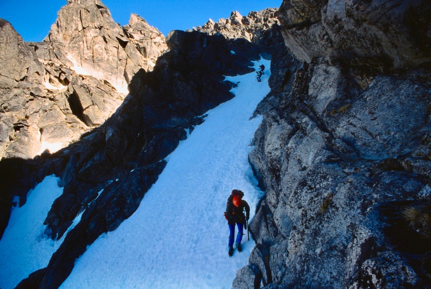

The first few inches was mush while the base was hard ice. The angle was steep enough that if you tried plunge stepping the heel would dig in just until it hit the ice and then slide along the crust.
This made descending very tedious. We had to turn around and face into the slope and kick foot holes, known as “pigeon holes”.
These toe holes also served as hand holds as you climbed down past them. One hand on an ice ax and one hand in a pigeon hole. This made for cold hands and is extremely tiring on the calves.
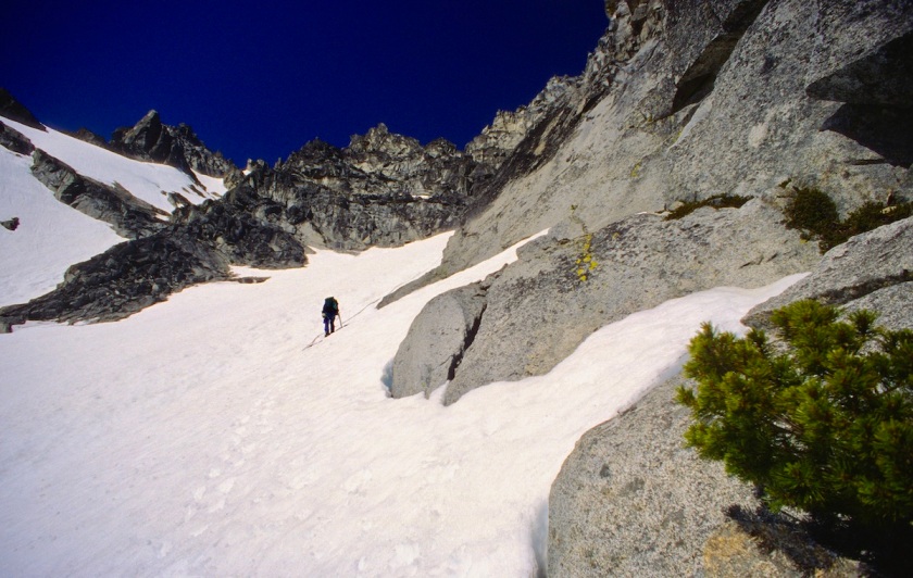
Rick was unsure of using his ax in the dagger position and so he used the slower self belay technique where the shaft is shoved down into the snow with each step. This is also more taxing on the arms.
We proceeded in this fashion for hours, taking small breaks on the steep ice and on little outcrops of rock when we could.
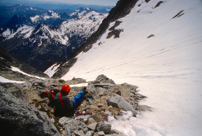
We began rappelling whenever we could find a half decent anchor to put a sling around. This would give us 200 feet at a time pretty quickly, although we had to move one at a time.
We rapped so many times that I can’t remember the exact number. Rappelling and pigeon holing, we made our way to where the gully pinched shut to a waterfall.
This was great at first because we had all the water we could swallow. We sucked it up like camels after crossing the Sahara.
The next problem was finding a way to rap past the falls without getting soaking wet. I led a traverse pitch off to the left and found a couple of loose blocks that were big enough to hold our weight.
We rapped again and down climbed to a short chimney and down to another steep area with another waterfall off to the right. The ropes were by now sopping wet and weighed 3 or 4 times what they had started at. As you rapped down your rappel device wrung ice water into your lap as the rope passed through. Just re-coiling the heavy ropes to move down a bit was enough to fry the arm muscles.
We came to a section that was very cliffy, with snow patches. We rapped and down-climbed through this to a section where the snow underneath us was hollow where the water had formed a cavern along the gully.
Punching through this would put you in deep shit. You would fall down steep icy rock and be pummeled by ice cold melt water after you got wedged into a bottle neck under the snow. Not a pretty thought.
So we continued to use the ropes to rappel. Rick broke through at one point but the ropes saved his ass from falling too far down. I rapped down yet another section as it was getting dark and moved off to the right to a cliffy area that showed some promise of getting us off the snow and out of the gully.
I hoped that we could do a couple of raps down to the talus field and pick our way through the moraine to the way trail. I scouted a spot to rap and went back to wait for the others to catch up.
When we were back together Tom told me that he thought I should look at my rope. Rick had dislodged a big rock and it had nicked the rope up pretty good. Captain avalanche had struck again.
I looked at it closer and the sheath had been completely cut through almost all the way around the rope along with a number of the weight-bearing strands. This truly sucked. Now we couldn’t make full rope-length rappels.
It was by now about 10:30 Sunday night and was pretty dark. The others (who all had real jobs to be at Monday) said they were OK doing another bivy. This was the safest decision, since we were all beat and had eaten very little food all day.
We carried on a bit, down to a fairly level spot for three of us while Rick had his own little spot. It was warmer than the previous nights, but this brought its own problems.
Much lower in altitude and thus warmer, mosquitoes now plagued us all night. I cinched up my hood to a small opening and they still made their evil way in to assault me. Rick’s face got pretty chewed up. Tom and Nichole could stick their heads down in their bivy sacks for some relief.
The night seemed to take forever with the bugs sucking our faces and hands dry, with us thinking about all the food, clothing and sleeping bags that had now been down at base camp unattended for three days.
Dawn finally broke and we stiffly got moving and started pulling on boots and packing up.


We then headed back into the gully for more snow and hollow ice bridges. Eventually we made it back down into trees and greenery after being up in snow and bare granite for so long.
We continued down to the stream and crossed it. We never found the way trail that was supposed to be there, so I led off cross-country back to our base camp.
This was a hoot also, the mountain was going to fuck with us all the way out. Crossing swollen creeks, devils club and alder thickets we made it back to our base camp.
We collapsed on our sleeping pads and proceeded to have a food orgy. We were eating all kinds of shit, cooking and drinking water for a couple of hours.
We slowly packed our remaining gear and now had heavier packs to hump back up to the pass. We moved cross-country again up towards the trail at Ingall’s pass.
There was plenty of soft snow to slog through and it was getting plenty hot in the big open bowl. Slog, slog, slog. Sweat, sweat, sweat.


Finally, we were back on an actual trail with solid steps kicked into the snow. I made it over to Ingall’s Pass before the others and tossed my pack off to wait on them.

Sitting there alone, I heard a helicopter over on the other side of the pass and wondered if it could be a rescue flight. About that time I saw the chopper flying low over the approach trail and thought “oh shit”.
The chopper flew right up and only about 30 feet over me. I waved and they waved back. “OK, maybe they are just sight seeing” I thought.


They continued following the tracks in the snow and flew over the rest of our group, heading right over to the West Ridge of Stuart.
As soon as they did that I knew they were looking for us. The chopper circled back around, by that time the rest of the team had caught up to me on the pass.
The helicopter took another low pass over us and then circled back again.
This time they were coming in much slower and there was an arm holding something out of a window. As it passed over our heads the arm tossed down a spare blank log book.
I ran over to grab it and just as I got to it, the rotor blast hit it and blew the log book and my hat down the slope about 50 yards. I climbed down to get my hat and the log book.
Tom found a note that had been inside the log book that read “wave if you are Nicole G”.

Nicole was immediately shocked to find out that someone she knew had sent a helicopter to find us, but waved back at the chopper and off it went back to wherever it had come from.
Then she was all worried that she would have to pay for the cost of the rescue attempt and all that. Of course we helped by telling her that she would indeed have to pay and that it would cost around $15,000 or so because aviation fuel and pilots are expensive. We started cracking jokes about all the news teams waiting down at the parking lot to interview her and all that.
It turns out that Nicole’s dad Dale, who had been recently diagnosed with cancer and given less than 6 months to live, was worried about his daughter and had called the ranger station to report us being a day late.
The ranger stated that they wouldn’t send a helicopter that soon because the weather was good, that we were on a hard route and were probably just behind schedule. This was all well before cell phones were in everyone’s pockets and we were now a day overdue to those that cared back home. Anyone that knew me and Rick would only be mildly concerned, as this was not uncommon for us.
Dale then asked how much it would be if he paid for a chopper to go and check on us. The ranger told him $600 and Dale told him to go ahead…so the ranger got a free scenic flight over Mt. Stuart. He was still pretty excited about getting a free (to him) helicopter ride when we reported into him over the phone after we got back to civilization.

We finished the last few miles down hill in the blast of heat and soaked our feet and washed off in the cold, clear creek that runs by the parking lot.

We sucked down a couple of beers from the car and celebrated our awesome, epic climb.

We then headed home to explain to all the worried people that we were not lost, just trying to be “safe”… if you can say that with a straight face about the route we had been on.
Altogether a very memorable time and yet another epic “classic” for the books… and Nicole had earned a new climber’s nickname…Chopper Girl.




No way! You are crazy!!! Glad you all made it out safely.
LikeLike
An amazing climb with unbelievable views. I remember being belayed over the missing ledge and looking straight
down 1000 feet to the landing zone if you fell, but falling was not an option, making the move was the only option. The mountain seemed to go on forever and many routes to nowhere that you did not want to take. Les is a great route finder and proved it many times. I read the route descriptions many times before we went and did not recognize many landmarks on our way up. We came off the mountain in an area we had never been to and Les was able to direct us in heavy timber to where our bivy site was. Like many of our climbs where we brought a guest, Nicole was a one and done with going on our climbs. Rick and I had total trust in Les and he never let us down. Sometimes I wonder if Les stopped planning these climbs because he knew we would always go with him and one day one of us might not come back.
LikeLike